
 Galileo could improve your phone’s location accuracy up to 100 times. Here’s how to find out if you can use it and what it can do.
Like other systems, Galileo is integrated at the chipset level. So, to benefit from its location services, your phone has to be manufactured with a Galileo-enabled chipset.
Nowadays, companies that account for 95% of the global supply of smartphone chipsets are in contact with the Galileo team. This means a vast majority of the new-generation of phones such as Apple’s iPhone X, Samsung’s S8, Huawei’s Mate 10 and Google’s Pixel 2 are all Galileo-enabled.
Below, a complete list of Galileo-enabled phones:
Apple: iPhone 8 Plus, iPhone 8, iPhone 10/X
BQ: Aquaris V Plus, Aquaris V, Aquaris X5 Plus, Aquaris X, Aquaris X Pro
Google: Pixel 2, Google Pixel 2 XL
Huawei: P10 plus, Mate 9 pro, P10, Mate 10 Pro, Mate 9
LG: V30
Mediatek: Meizu Pro 7 Plus, Meizu Pro 7
Motorola: Moto X4
Nokia: Nokia 8
Oneplus: Oneplus5
Samsung: S8, S8+, Note 8
Sony: Xperia XZ Premium
Vernee: Apollo 2
If your phone is on this list, it means that your phone is using Galileo’s signals whenever you access an application that uses location services.
Whereas nowadays most recently-launched phones carry the Galileo chipset, the first phone to be compatible with the European navigation system was built by Spanish tech company BQ.
“It was important for us to have an European phone first and we have the cooperation with BQ to launch the first model ready even before the first Galileo satellite was launched. Later, we cooperated with many more brands and today the main players have already adopted Galileo”, tells Justyna Redelkiewicz, Head of Sector Location Based Services at the European GNSS Agency (GSA).
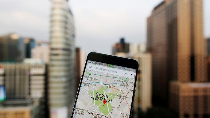
How accurate is Galileo?
Today, in areas surrounded by buildings, location services can determine your location between 100 to 50 meters in accuracy, although many combine different technologies to improve this.
“This is not enough because sometimes you want to see at what side of the road you are standing when you’re crossing, or in which lane you’re driving” explains Redelkiewicz.
With Galileo’s dual-frequency technology location can be pinpointed by less than one metre in accuracy in the best possible conditions, or by just a few meters if conditions are less ideal.
Dual-frequency is already available for professional use and will soon be available to consumers on mobile phones. As the name suggests, it means the device will have two sources from which to determine your location, greatly reducing the chance of error.
Cities are an issue for location services because buildings either block or reflect the signal being sent from satellites. This is why sometimes your location appears to be bouncing from place to place when you’re using a navigation app, for example.
The Galileo navigation system will eventually have double the amount of satellites than the GPS, meaning more signals will reach the device despite surrounding buildings. At the same time, it can distinguish reflected signals from direct ones, improving accuracy.
What are the major benefits and uses of having a more precise location service?
The obvious benefit from Galileo data being present on smartphones is easy and accurate navigation, getting around from place to place whether by foot, car, bicycle, boat, train or plane. But its precision opens the door for a number of other applications.
- Emergency services
Better location services means locating someone in an emergency with more rapidity and precision.
Nowadays, special devices allow hikers or climbers to send a distress signal when lost or in danger. This device is also available on ships and planes.
But the Galileo team also aims to further improve search and rescue.
“We’re working with search and rescue professionals, so that in the future, if someone is in distress they can send an alert with their location, asking to be rescued from their phone. It will bring a peace of mind for anyone who is looking for help,” explains Gian Calini, GSA’s Head of Market Development.
- Geofencing
Geofencing virtually delimits a geographical area.
This is particularly useful when tracking a child or an elderly person suffering from illness.
So, if the child leaves the school area or if an elderly person leaves the residence carrying their phone, it can notify those looking after them.
- Gaming
Games that use location and augmented reality, such as the famous PokemonGo or the yet-to-be-released The Walking Dead: Our World, will be taken to a whole new level.
These games require location accuracy because the augmented reality needs to match the real environment.
Better location precision will allow for a better integration of the virtual environment with the user’s surroundings in real time.
- Advertising
Location-based advertising means businesses can offer coupons or discounts which are relevant to your geographical position.
It combines consumer preferences with positioning data to provide personalised offers.
So, if you’re driving next to a certain gas station, you can receive vouchers for a free coffee, for example.
Beyond smartphones
Galileo offers a number of possibilities that go beyond the use of mobile phones and affect our global economy.
Justyna Redelkiewicz draws attention to the fact that “smartphones are only one access point” of Galileo and that many other devices also receive Galileo data. There’s “a whole world of different applications that go beyond smartphones”, she adds. You can find more about these here.
Eleven percent of the global GDP depends on location services, so Galileo has a major importance in the world’s economy. Gian Calini highlights that “If for whatever reason some of the other systems is switched off instead of losing money, Europe has it’s own system. So there are also strategic and economic reasons behind Galileo’s services.”
I really look forward to using Galileo one day, but the Nokia 8 (TA-1004 DS NORDICS) handset I just bought doesn’t seem to support the European GNSS system. Can this be caused by the upgrade to Android 8 Oreo which was implemented before I even saw what the previous version of the OS looked like?
Nokia 8 should be Galileo-ready according to the most up-to-date list of smartphones supporting Galileo published on http://usegalileo.eu/
I’ve since been using Galileo practically every day.
Check availability using the GPSTest app by Barbeu. It goes into a lot of detail, lists all the available satellites and shows you position on a map, even where you’re sitting in your house…
Will Galileo enabled handsets simultaneously also use the American GPS and Russian GNSS satellites maximising coverage by better overall satellite geometry, as well as benefitting from the enhanced accuracy of the Galileo satellite system?
How can I check if my device see a galileo satellite?
Seems that my meizu Pro 7 plus (Helix P30) does not see any Galileo signal …
Some of the listed devices do not support Galileo in some markets. Some devices may be reported on the basis of chipset capability, but device manufacturers may choose to reduce costs by not having some capabilities enabled, or may not bother to support capabilities in software. The list is also out of date and does not contain some current devices.
The agency responsible for this website knows all of this but doesn’t care.
Thanks Alan for your comment.
Please, visit https://www.usegalileo.eu/EN/ for an accurate and up-to-date list of #Galileo enabled devices.
Why is none of the big phone builder uses dual frequency GNSS?
This will be a matter of time. Xiaomi Mi 8 was the first dual-frequency GNSS smartphone. For sure, it will not be the last.
I’m in the UK , Northwest, and had my Google Pixel 2 a year now and using GPS test have never been locked onto a Galileo satellite let alone seen one. Why?
Bought phone to geocabing thinking this phone woulhelp . Also tried accuracy using an car OBD2 engine monitoring app and report 3-4 m accuracy like the GPS test app.
the two more common problems with gps and waze or gps and google maps, is the down town of cities like sevilla, spain , with narrow streets, and the frontage road (also known as an access road, service road or parallel road) of highways where it doesn’t detect if you are in the main or in the frontage.
So, please upload videos to youtube where i can see in them that these problems are fixed with galileo gnss. thanks
Dear Ivan,
As you have spotted, urban canyons are one of the main vulnerabilities to GNSS signals. One of the features of Galileo to achieve better accuracy under this scenario is multifrequency, navigation signals transmitted in several frequency bands. Another important point is that Galileo and GPS are interoperable, meaning that having more satellites in view will help you to have a more accurate positioning.