
The key in the positioning computation is the pseudorange or distance to the satellite. The navigation receivers calculate the pseudorange to each satellite under visibility by measuring the elapsed time between the transmission and reception of GNSS signals. To compute the position of a GNSS receiver a minimum of 4 satellites under visibility (4 pseudoranges) are needed, although the accuracy will improve with higher number of satellites.
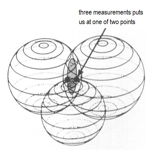
Graphically the calculated pseudorange to any satellite is represented as a sphere which radius is this same distance, being the satellite in the centre. Imagine we have 3 satellites under visibility, represented as 3 spheres. Therefore, as shown in the figure below, the receiver must be located in one of the 2 points where the 3 spheres meet. To discard one of them and to finally discover our position a fourth satellite is needed.
Positioning computation