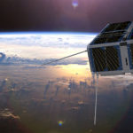
FFSCat – providing complementary data to the Sentinel fleet – wins the 2017 Copernicus Masters, the international competition on innovative solutions for business and society based on Earth observation (EO) data. Read more…


FFSCat – providing complementary data to the Sentinel fleet – wins the 2017 Copernicus Masters, the international competition on innovative solutions for business and society based on Earth observation (EO) data. Read more…

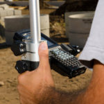
EUREF, the International Association of Geodesy (IAG) Reference Frame Sub-Commission for Europe, is dedicated to the definition, realisation and maintenance of the European Geodetic Reference Systems. Included in this mission is the development and maintenance of the EUREF GNSS Permanent Network (EPN), which is a ground-based GNSS infrastructure for scientific and practical applications in positioning and navigation. EUREF provides standards and guidelines to European National Mapping Authorities in order to harmonise the definition and adoption of national coordinate reference systems. Read more…