Author Archives: Galileo GNSS
The shift towards a multi-constellation GNSS environment
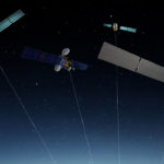
With the launch of Galileo Initial Services and the availability of numerous Galileo-enabled chipsets and receivers, users are benefiting from the stronger GNSS performance that a multi-constellation environment provides.
As the GSA’s GNSS Market Report shows, the global GNSS market remains dynamic. GNSS is used around the globe, with 3.6 billion GNSS devices in use in 2014. By 2019, this is forecasted to increase to over 7 billion – an average of one device per person on the planet. Smartphones continue to dominate, being the most popular platform to access location-based services, followed by devices used for road applications. Other devices may be less numerous, but billions of passengers, professionals, consumers and citizens worldwide benefit from their application in efficient and safe transport networks, in productive and sustainable agriculture, and in surveying and critical infrastructures. Read more…
Development, Supply and Testing of Galileo Open Service

Because of this, the GSA has launched a new funding opportunity to support the development, supply and testing of a Galileo Open Service authentication user terminal. The Galileo OS will soon provide a Navigation Message Authentication (NMA) feature, known as OS-NMA. Via this feature, users can verify that a navigation message comes from a Galileo satellite and not a potentially malicious source. The Open Service is the Galileo program’s free service for positioning, navigation and timing. Read more…
Galileo and EGNOS test campaign for eCall devices

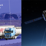
The testing initiative follows the 17 January 2017 publishing of European Commission Delegated Regulation (EU) 2017/79. According to the regulation, all new M1 (passenger cars) and N1 (light duty vehicles) types must be equipped with eCall in-vehicle systems as of 31 March 2018. Read more…
New Authentication Method to Make Sending False Galileo Signals More Difficult

Smart cities get a boost from Galileo

The idea behind GHOST (Galileo EnHancement as BoOster of the Smart CiTies) is simple yet incredibly effective. Instead of requiring heavy investment in new technologies, the consortium makes use of existing public transport solutions and connects them to a web portal by means of a camera equipped with a Galileo receiver. Once set up, the system takes pictures of predefined POIs, sends them to an image processing server that automatically detects anomalies, and reports these anomalies to relevant authorities by means of a web portal. Read more…
Septentrio GNSS technology guarantees DEME’s operations in areas of interference

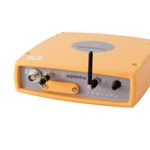
DEME is using Septentrio’s AsteRx GNSS receivers to obtain centimetre-level accuracy for all their dredging and marine construction operations worldwide. These receivers are specifically designed to operate in difficult conditions: from ice-covered Arctic ports to the tropical climates of Southeast Asia; whether dredging a few metres from the coast line to constructing wind turbines kilometres out at sea. Read more…

