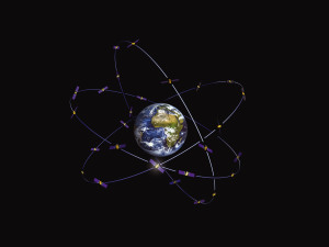
With 18 Galileo satellites in orbit, supporting ground infrastructure, and after an extensive testing period, Galileo Initial Services are now available for public authorities, businesses and citizens. From now on, users around the world can be guided using the positioning, navigation and timing information provided by Galileo’s global satellite constellation. Read more…
Category Archives: Galileo Services
Galileo initial services available #GalileoGoesLive #MyGalileo
Europe’s own Galileo satellite navigation system has begun operating, with the satellites in space delivering positioning, navigation and timing information to users around the globe.
This animation shows how service availability increases as the overall number of satellites in the Galileo constellation goes up.
Today, the European Commission, owner of the system, formally announced the start of Galileo Initial Services, the first step towards full operational capability. Read more…
Galileo to Go Live on Thursday
Europe’s Global satellite navigation system is all set to go live this Thursday. Seventeen years and more than 10 billion euros ($11 billion) later, Europe’s Galileo satnav system promises to outperform US and Russian rivals while boosting regional self-reliance. Initial services will be free to use worldwide on smartphones and navigation boxes fitted with Galileo-compatible microchips. Some devices may only need a software update to start using the new technology, as several smartphone companies were already making chips compatible with it.
At first the signals might be a little weak but will be boosted with help from satellites in the US military-run GPS system, and grow stronger over time as orbiters are added to the now 18-strong Galileo network orbiting 23,222 kilometres (14,430 miles) above Earth. Read more…
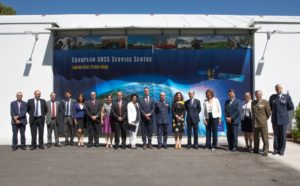
GSA accepts Loyola de Palacio facility – home of the GSC in Madrid

“The GSC is a key asset for the Galileo programme; it is Galileo’s door to the GNSS world,” said GSA Executive Director Carlo des Dorides. “Today, the GSA is pleased to accept this excellent facility from Spain. It is a symbol of the upcoming service phase and the single, unique interface for Galileo users.” Read more…
The Galileo PRS, Public Regulated Service
The Galileo Public Regulated Service (PRS) is an encrypted navigation service for governmental authorised users and sensitive applications that require high continuity. The GSA actively contributes to the development of all areas of PRS user segment to continuously respond to user needs, and supports a wide and secure use of PRS in compliance with the PRS Decision 1104/2011.
What is PRS?
PRS is similar to Galileo’s Open and Commercial GNSS services, but with some important differences:
- PRS will ensure better continuity of service to authorised users when access to other navigation services may be degraded (resilience).
- In cases of malicious interference, PRS increases the likelihood of the continuous availability of the Signal-in-Space (robustness).
First EGNOS LPV-200 approach

Google opens up GNSS pseudoranges
Google has announced that raw GNSS measurements will be available to apps in the Android N operating system, which will be released later this year. This means pseudoranges, dopplers and carrier phase will be obtainable from a phone or tablet computer.
The announcement came during Google’s I/O 2016, its three-day developer conference which was held May 18-20. The specific announcement occurs during a video summary of the conference, shown below.
“This is groundbreaking,” says Steve Malkos, a technical program manager at Google. “It is the first time in history that a mobile application will have access to Read more…

