Category Archives: Other

Galileos 19-22 near completion

Macron, Juncker and Wörner visit Europe's Spaceport

Macron, Juncker and Wörner
visit Europe’s Spaceport

The Galileo global navigation satellite system has been offering initial services since almost a year and the performances are great. Independent measurements and evaluation of the system show that the European system is currently the best satellite positioning system in the world.

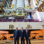
A symbolic image of the European Space Port in Kourou (French Guiana) as the President of the European Commission Jean-Claude Juncker, the French President Emmanuel Macron, and
the Director General of the European Space Agency Jan Wörner, stand in front of the Ariane 5 launcher, which will soon carry 4 more Galileo satellites into space.

On 12 December at 19:36 CET, an Ariane 5 will launch from Kourou with 4 new Galileo satellites, adding to the constellation which is set to be completed next year.

Mid-term evaluation of Galileo by the Council of EU

Mid-term evaluation of Galileo by the Council of EUEU Ministers for Transport, Infrastructure, and Communications meet on 4 and 5 December 2017 in Brussels to agree their position on an updated mandate for the Body of European Regulators for Electronic Communication (BEREC). Ministers also look at the progress made on a proposal on ePrivacy and discuss draft rules on the free flow of non-personal data. On Tuesday, the Council takes stock of the progress made on the mobility package proposals relating to market access and social aspects and discusses the road charging proposals. Ministers look at the progress made on the proposal to safeguard competition in air transport. The Council is also due to adopt three sets of conclusions.

The Council adopted conclusions on the report by the Commission containing a mid-term evaluation of Galileo, EGNOS and the performance of the European GNSS Agency. The conclusions underline the strategic importance of Europe’s satellite navigation systems and set out a number of recommendations on their implementation and evolution. Read more…

FFSCat Overall Winner at the Copernicus Masters 2017

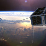
FFSCatFFSCat, a constellation of federated satellite systems, offers the highest investment return, improved revisit time, scalable approach, and graceful performance degradation at the end of the satellites’ life.

FFSCat – providing complementary data to the Sentinel fleet – wins the 2017 Copernicus Masters, the international competition on innovative solutions for business and society based on Earth observation (EO) data. Read more…

Mass GPS Spoofing Attack in Black Sea?

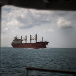
GPS Spoofing Attack in Black SeaReports of satellite navigation problems in the Black Sea suggest that Russia may be testing a new system for spoofing GPS. This could be the first hint of a new form of electronic warfare available to everyone from rogue nation states to petty criminals.

On 22 June, the US Maritime Administration filed a seemingly bland incident report. The master of a ship off the Russian port of Novorossiysk had discovered his GPS put him in the wrong spot – more than 32 kilometres inland, at Gelendzhik Airport. Read more…

The synergies between GNSS and Earth Observation

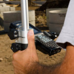
Synergies between GNSS and Earth Observation provide real-time information about the state of the Earth’s troposphereSpeaking at a dedicated session entitled “Applications: Earth Sciences and Geo-Information”, part of EUREF’s annual symposium, representatives of the mapping and surveying sector discussed the various synergies between GNSS and Earth Observation and their use for providing real-time information about the state of the Earth’s troposphere.

EUREF, the International Association of Geodesy (IAG) Reference Frame Sub-Commission for Europe, is dedicated to the definition, realisation and maintenance of the European Geodetic Reference Systems. Included in this mission is the development and maintenance of the EUREF GNSS Permanent Network (EPN), which is a ground-based GNSS infrastructure for scientific and practical applications in positioning and navigation. EUREF provides standards and guidelines to European National Mapping Authorities in order to harmonise the definition and adoption of national coordinate reference systems. Read more…

Interview with O. Montenbruck and P. Teunissen, editors of Handbook on GNSS

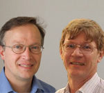
O. Montenbruck and P. TeunissenOliver Montenbruck (left picture), Head of the GNSS Technology and Navigation Group at DLR’s Space Operations Center and Peter Teunissen have edited an exhaustive reference work, the Springer Handbook of Global Navigation Satellite Systems, which brings together international experts to provide a state-of-the-art description of all facets of Global Navigation Satellite Systems.

Besides the obvious things, like navigation software in our cars and smart phones, which service or tools we use in our daily life, would not be possible without GNSS and would be deeply missed?
Peter Teunissen: GNSS radio occultation measurements provide important input for near-real-time weather forecast.
Oliver Montenbruck: Complex power grids and even stock exchanges would not work well without GNSS timing. Read more…

Handbook on GNSS published by Springer

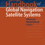
Springer Handbook of Global Navigation Satellite Systems

Springer Handbook of Global Navigation Satellite Systems

The Springer Handbook of Global Navigation Satellite Systems is now available.

Described as “A state-of-the-art description of GNSS as a key technology for science and society at large,” the 1,327-page tome is edited by Peter J.G. Teunissen and Oliver Montenbruck.

Teunissen is a professor of Geodesy and Satellite Navigation at Curtin University, Australia, and Delft University of Technology (TU Delft), the Netherlands.

Montenbruck is head of the GNSS Technology and Navigation Group at the DLR’s German Space Operations Center, Oberpfaffenhofen, and chair of the Multi-GNSS Working Group of the International GNSS Service. Read more…