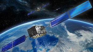
The Galileo satnav system began operating on 15 December 2016, offering positioning, navigation and timing services to everyone with a receiver. Service availability is based on a minimum of four satellites being visible in the local sky, set to improve as the number of satellites increases from the current 18 to a planned 24 plus orbital spares.
Satellite navigation in general has become an essential tool for scientists, with satnav receivers employed for instance to monitor the slow movement of tectonic zones, chart shifts in polar ice or to probe the ionosphere and other atmospheric layers.
Satnav also underpins activities such as animal tracking or drone monitoring, while the resulting timing accuracy down to a few billionths of a second allows for all kinds of precise fundamental physical measurements and experiments.
“The continuity and improved availability of Galileo provides a whole new source of positioning and timing data for scientific purposes, to be used either in isolation or in combination with other satellite constellations,” explains Javier Ventura-Traveset, leading ESA’s new Galileo Science Office.
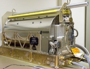
“Galileo also offers various specific advantages for scientific use, with the Passive Hydrogen Maser atomic clocks on each satellite an order of magnitude more precise than all previous clocks flown for navigation purposes, multiple transmission frequencies with robust modulation and wide bandwidth, stable orbits avoiding Earth rotation resonances, the absolute calibration of satellite antennas plus onboard laser retroreflectors that allow the satellite orbits to be characterised down to within centimetres.”
Galileo is also committed to maximum transparency in the service of science: last week the operational ‘metadata’ associated with the first four Galileo satellites, known as the In-Orbit Validation satellites, was made public by the European GNSS Service Centre.
ESA’s Galileo Science Office
To start putting Galileo to work for scientists, ESA’s Directorate of Galileo Programme and Navigation-related Activities has joined with the Agency’s science directorate to establish this Galileo Science Office, based at ESA’s centre near Madrid, Spain.
“The main objective of this office is to foster the consolidation of a world-wide reference European Global Navigation Satellite System (GNSS) scientific community, maximising the possibilities to perform GNSS science activities in Europe and also maximising the use of the European GNSS infrastructures and data.
“The office will also ensure the proper feedback of the scientific community to the GNSS teams, in particular with respect to the expected evolution and adaptation of the GNSS Infrastructure.”
The scientific employment of Galileo started early, with two satellites in elongated orbits now being used to measure more precisely how gravitational changes influence the passing of time – the gravitational redshift effect, first predicted by Albert Einstein.
International colloquium
Next year will see the next in a biennial series of workshops devoted to the scientific use of satnav systems: the 6th International Colloquium on Scientific and Fundamental Aspects of GNSS and Galileo.

