Besides the obvious things, like navigation software in our cars and smart phones, which service or tools we use in our daily life, would not be possible without GNSS and would be deeply missed?
Peter Teunissen: GNSS radio occultation measurements provide important input for near-real-time weather forecast.
Oliver Montenbruck: Complex power grids and even stock exchanges would not work well without GNSS timing.
What are the most important research topics in the field of GNSS?
Oliver Montenbruck: Precise point positioning, satellite-based remote sensing and merging the data from multiple global navigation satellite systems.
Peter Teunissen: Processing weak signals and maintaining the system integrity of safety-critical applications.
What, in your opinion, has been the most significant advancement in last 10 years?
Peter Teunissen: The number of visible satellites has been expanded significantly through new constellations. New and high-quality signals are now available.
What are the biggest challenges for the field still ahead?
Oliver Montenbruck: Resilient Position, Navigation, and Timing (PNT) services to protect GNSS and augmenting it with other techniques to cope with its vulnerability towards jamming and spoofing. Moreover, the frequency usage: ensuring protection of the current GNSS frequency bands while expanding to new frequencies.
Peter Teunissen: To improve precise point positioning atmospheric modeling needs to evolve. Furthermore, using “all” available GNSS receivers, sometimes called “Big Data” GNSS, will enhance precise point positioning.
How can GNSS help in the context of the grand societal challenges, e.g. climate change?
Oliver Montenbruck: GNSS radio occultation observations make important contributions to weather and climate monitoring. GNSS-based high-precision orbit determination of satellites in low Earth orbits helps to monitor the sea surface level and its relation with global warming.
Peter Teunissen: GNSS reference stations and buoys contribute to disaster monitoring and earth quake or tsunami warning. GNSS reflectometry from space might be the crucial ingredient for the development of a future rapid global warning system.
What is the most exciting part of your current research?
Oliver Montenbruck: Even 30 years after the introduction of global satellite navigation, new GNSS processing schemes arise every year that advance the performance and open up new applications.
Peter Teunissen: There is definitively a high innovation potential in the field.
How would you describe the experience of editing the book?
Oliver Montenbruck: Like mastering a flea circus!
Peter Teunissen: But holding the first copy of the book in my hands after 5 years of hard work was definitively a highlight.
For whom is this book a “must-read”?
Peter Teunissen: We believe the book to be an invaluable resource for scientists, engineers, students and institutions alike.
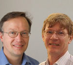
*Oliver Montenbruck (left picture), Head of the GNSS Technology and Navigation Group at DLR’s Space Operations Center
*Peter Teunissen (right picture), Professor of Geodesy and Satellite Navigation at Curtin University and Delft University of Technology.
