Tag Archives: European GNSS Agency

European GNSS Agency (GSA)

2016 GNSS User Technology Report

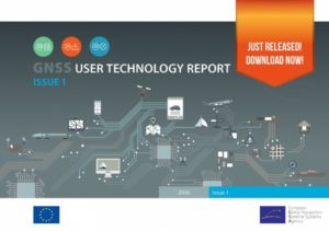
2016-gnss-user-technology-reportThe 2016 GNSS User Technology Report is the go-to source for comprehensive knowledge and information on the dynamic, global GNSS user technology industry and the latest trends. The publication takes an in-depth look at the latest in state-of-the-art GNSS receiver technology, along with providing expert analysis on the evolutionary trends that are set to redefine the global GNSS landscape.

The report focuses on three key macrosegments:

  • mass market solutions
  • transport safety and liability-critical solutions
  • high precision, timing and asset management solutions

DOWNLOAD the 2016 GNSS user technology report.

The 2016 GSA GNSS User Technology Report begins with a comprehensive overview of GNSS user technology. This is followed by a macrosegment analysis that focuses on receiver design, innovative signal processing techniques, changes that have an impact on antennas, and GNSS vulnerabilities – and how to mitigate them. Read more…

First Galileo Hackathon

Didactic disco

Didactic Disco team

The first ever European GNSS Agency (GSA) Galileo Hackathon brought together teams of passionate coders and geo enthusiasts from around the world to compete for some impressive prizes. The venue was Berlin’s Beuth University of Applied Sciences on 3 and 4 November during the sixth WhereCamp ‘unconference’ dedicated to geolocation enthusiasts and professionals. All the Hackathon competitors received a Galileo-ready BQ Smartphone and a certificate, while the two winning teams also each collected a €500 cash prize.

WhereCamp Berlin on 3 and 4 November was the place to be for movers and shakers shaping the future of Location Based Services (LBS) and Geo-IoT (Geolocation in Internet of Things). The first Galileo Hackathon was a unique opportunity to showcase coding skills, connect with the Geo-IoT app development community, and to gain a competitive insight on what Galileo LBS will be bringing to the smartphone in your pocket in the very near future. Read more…

Satellite navigation at core of future connected car systems

driverless-car-02At the joint “Insurance Telematics” and “Connected Cars” conference in London, vehicle manufacturers, software engineers, public authorities and many more heard how GNSS and internet-enabled vehicles are changing the road transport landscape.

Major vehicle manufacturers are now delivering motor vehicles with connected services for drivers, including real-time traffic and weather reports and accident or road works warnings. More applications are on the way, and the technology systems that support them will enable the increasing number of autonomous vehicles that will soon be cruising down our roads and highways. Read more…

GSA accepts Loyola de Palacio facility – home of the GSC in Madrid

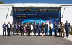
GSC acceptance meetingThe European GNSS Agency (GSA) has formally accepted the new Loyola de Palacio facility, which houses the European GNSS Service Centre (GSC), from the Spanish government, a key milestone in the development of the Galileo programme and its service provisions, which is scheduled to begin later this year with the declaration of Initial Services.

“The GSC is a key asset for the Galileo programme; it is Galileo’s door to the GNSS world,” said GSA Executive Director Carlo des Dorides. “Today, the GSA is pleased to accept this excellent facility from Spain. It is a symbol of the upcoming service phase and the single, unique interface for Galileo users.” Read more…

BQ Aquaris X5 Plus. First European Galileo-ready smartphone

BQ Aquaris X5 PlusSpanish technology company BQ announces that their new Aquaris X5 Plus smartphone will be the first European Galileo-ready smartphone to hit the market.

In anticipation of the planned launch of Galileo Initial Services later this year, the European GNSS Agency (GSA) welcomes the first European Galileo-ready smartphone. The Aquaris X5 Plus smartphone, produced by the Spanish technology company BQ, is based on the Galileo-supported Qualcomm Snapdragon 652 processor, with Galileo capability accessible via a software update to be released in Q4 2016. Read more…

First EGNOS LPV-200 approach

First EGNOS LPV-200 approachThe GSA announces that the first LPV-200 approaches were implemented at Paris Charles de Gaulle Airport (LFPG) on 3 May, the first such approaches to be implemented in Europe. LPV-200 enables aircraft approach procedures that are operationally equivalent to CAT I instrument landing system (ILS) procedures. This allows for lateral and angular vertical guidance during the final approach segment (FAS) without requiring visual contact with the ground until reaching a decision height (DH) of only 200 feet above the runway. (The minima for localiser performance with vertical guidance, or LPV, are as low as 200 feet.) Read more…

GNSS-enabled bicycle

GNSS enabled bicycleFrom a country that has given us such international icons as wooden shoes, windmills, canals and narrow houses, perhaps nothing symbolises the Netherlands more than the bicycle. So when the European Space Expo landed in The Hague’s Het Plein, it was only natural that it came with a special exhibition on the role space solutions play in cycling and motor biking.

The Space Solutions for Biking event showcased the many innovative biking applications powered by satellite navigation (EGNOS and Galileo) and Earth observation (Copernicus) technology. Exhibiting companies covered an array of applications, including bike sharing, smart bike riding and emergency detection for motorbike riders. Read more…