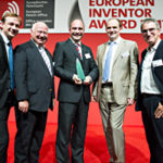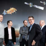
A European team, led by French engineer Laurent Lestarquit and his Spanish colleague José Ángel Ávila Rodríguez and including German Günter Hein and Belgian Lionel Ries, has a unique specialism: sending clear signals from space. A virtual cacophony of radio frequencies is sent down to earth from the more than 50 navigation positioning satellites currently in orbit – including those of the US-led Global Positioning System (GPS), Russia’s Global Navigation Satellite System (GLONASS) and more recently Europe’s Galileo system. This team has helped ensure that signals do not interfere with each other, and that users and developers alike will be able to profit from the next-generation positioning technology that Galileo offers.
The team’s contribution of modulation and spread-spectrum signal technologies forms one of the joint European satellite positioning system’s core components, delivering signals that enhance accuracy, save on satellite power and ensure interoperability with GLONASS and the current GPS and its possible upgrades.
When fully operational in 2020, Galileo will be the most advanced and accurate GNSS in the world, with horizontal and vertical positioning accuracy to within a metre for standard signals – and within a few centimetres when using high-end signals and precise positioning techniques. It will also provide better positioning services at high latitudes, advanced global search-and-rescue functions and a host of other capabilities.
Societal benefit
Apart from initial gains in navigational and positioning accuracy, Galileo will benefit its users thanks to a forward-looking concept designed to work with emerging technologies ranging from autonomous driving and travel optimisation to machine-to-machine communication and the Internet of Things.
In the not-so-distant future, GNSS is likely to have a direct influence on transport, increasing time and fuel savings as well as improving safety. Galileo might be incorporated into national road toll systems, support smart agriculture to make better use of available land and aid in more accurate surveying.

Galileo stands to enrich such an array of public, private and research applications, because it is specifically designed for civilian use – unlike GLONASS and GPS, which have their roots in military applications. The system reserves one secured signal for strategic and security applications, but leaves the rest open to the public, ensuring Europeans and all other users access to an independent satellite navigation system.
Economic benefit
Galileo aims to raise Europe’s share in the global GNSS market, which will generate an estimated EUR 350 billion in annual revenues by 2020. A 2015 European GNSS Agency report predicts that the global GNSS downstream market (the full retail price of devices with GNSS chipsets) will see a 7% compound annual growth rate during this period, outpacing global GDP.
GNSS technologies are spurring on companies ranging from massive mobile phone and device manufacturers to tiny global positioning speciality firms. According to AZO, a start-up facilitating agency, in the German state of Bavaria alone there are 119 start-ups implementing or exploiting Galileo signals, which employ about 1 600 people in high-tech jobs and produce an estimated EUR 130 million in combined annual turnover.
When Galileo is fully operational in 2020, with the planned total of 30 satellites – counting six spares – it is expected to lead to significant economic benefits, including R&D investment by the aerospace sector generating a social return of around 70%. In other words, for every EUR 100 million invested in R&D, GDP should grow by EUR 70 million in other sectors over the longer term.
Once fully operational, Galileo is expected to have an economic impact of EUR 90 billion over the next 20 years.
How it works
Lestarquit developed a patented modulation technique called Alternative Binary Offset Carrier modulation (AltBOC), which effectively packs four signals into one large one: two highly accurate signals from Galileo’s open service – the free-of-charge channel for consumer applications – and two signals from its Safety-of-Life service – a paid service designed for applications such as aviation, where lives might depend on signal integrity. AltBOC not only offers extremely high accuracy for specialised receivers, it also helps save satellite power.
The team has also developed an innovative spread-spectrum technique that creates a new single waveform via what is called Composite Binary Offset Carrier (CBOC) modulation. This signal will allow high-end receivers to accurately calculate positions, but is also compatible with older, lower-end devices and other GNSS signals. The CBOC patent includes a novel concept allowing the combination of open CBOC and secured Public Regulated Service (PRS) signals in a single frequency. PRS signals are designed to be used by civil authorities, such as police, coastguards and customs agencies. PRS is encrypted and includes anti-jamming mechanisms.
The inventors
The inventor of AltBOC modulation and co-inventor of the CBOC waveform, Laurent Lestarquit became interested in GNSS technology while it was an emerging field not yet taught at university. He graduated from the French Space and Aeronautics Institute in 1996, one year after GPS went live. Aside from his work on AltBOC and CBOC, he has contributed to the development of the PRS signal and was part of the French delegation at the GPS and Galileo negotiations, which determined the parameters for compatibility of the two systems. Lestarquit’s navigational pursuits extend beyond his career: he has competed in high-level orienteering contests using traditional, non-GNSS skills to navigate. He has also been a navigator in the international, off-road “Camel Trophy” race.
Ávila Rodríguez received his PhD in Aerospace Engineering from the German Federal Armed Forces University in Munich and over the past 15 years has held GNSS engineering positions, worked as a senior consultant and served as a manager or member of numerous GNSS-related programmes. Ávila Rodríguez, who has authored or co-authored over 60 scientific articles in the field of satellite navigation, has held the position of GNSS Evolutions Signal and Security Principal Engineer at the European Space Agency since 2015. He is the recipient of numerous awards for his work in the field of GNSS.
Supporting Ávila Rodríguez and Lestarquit were principal members of the Galileo Signal Task Force and co-inventors of the CBOC patent: Frenchman Jean-Luc Issler, who not only helped assemble the team, but also develop one of the other frequency bands used by Galileo; German academic Günter Hein, who developed and taught navigational technology and design in a career spanning over 40 years; and French-Belgian national Lionel Ries, who has authored or co-authored 25 patents and about 100 research papers, mostly relating to satellite navigation.
Did you know?
Global positioning with satellites has a myriad of applications and one of the most distinct is to give further evidence to support Albert Einstein’s theories of special and general relativity. Special relativity postulates that, the faster an object travels, the slower the time on the object elapses relative to a slower moving body. General relativity sees gravity as a curvature in “spacetime”, where more massive bodies bend time and space around them.
Both theories are measurable through GNSS technology. Fast-moving global positioning satellites equipped with atomic clocks show a relative time shift of about 7 additional microseconds (millionths of a second) per day due to their roughly 14 000-km/h orbit speeds. However – pushing time in the other direction – the effects of a lessened gravitation pull (less spacetime curvature) actually cause their clocks to run 40 or so microseconds faster than they would on Earth.
Galileo’s atomic clocks accommodate these principles, and other “time-changing” phenomena like the Sagnac effect caused by the Earth’s rotation, by slightly slowing their clock speeds and synchronising every 100 minutes or so. It’s interesting to know that the technology being employed in your GNSS device is helping to prove Einstein right, then.
About the European Inventor Award
The European Inventor Award, now in its 12th year, is one of Europe’s most prestigious innovation prizes. Launched by the European Patent Office (EPO) in 2006, the annual award distinguishes individual inventors and teams of inventors whose pioneering inventions provide answers to some of the biggest challenges of our times. To qualify for the award, proposals have to meet specific criteria, including that the inventor had to have been granted at least one European patent for their invention by the EPO.
The finalists and winners in five categories are selected by an independent jury consisting of international authorities in the fields of business, science, academia and research, who examine the proposals in terms of their contribution towards technical progress, social development, and wealth and job creation in Europe. This year’s 15 finalists were selected from more than 450 proposals – the highest number ever put forward for the award. The winner of the Popular Prize is chosen from among the 15 finalists by online voting in the run-up to the ceremony.
