Satnav loss might shut down sea, warns ESA-backed study

Satellite navigation is precise, reliable and available continuously around the globe, but overreliance on it presents a clear and present danger to the smooth passage of maritime trade, concludes a major ESA-backed study.

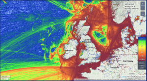
Maritime traffic around British Isles

Maritime traffic around British Isles

With seaborne trade projected to double by 2030, the MarRINav project used a simulation approach to ‘stress test’ current navigation methods along highly trafficked shipping lanes around the British Isles. Every day more than 1.36 million tonnes of cargo arrive at major UK ports, guided predominantly by signals from space. Read more…

GPS III introduced on EGNOS services

Introduction of the first GPS III satellites into EGNOS services was successfully achieved on 27 July 2020, following the initiation by GPS of a transition from its “GPS Block II” satellites to its new generation “GPS Block III” satellites.

The EGNOS SoL service has improved following the successful GPS III introduction

The EGNOS SoL service has improved following the successful GPS III introduction

The GPS operational constellation started in 2020 to migrate from GPS II satellites to the new generation GPS III satellites. Through cooperation exchanges with the US, the European Commission and the European GNSS Agency (GSA) obtained assurance on the “backward compatibility” of the GPS III satellites with regard to GPS II, and in particular concerning their failure characteristics. Read more…

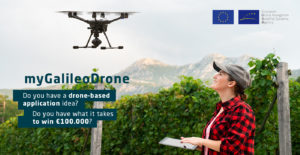
#MyGalileoDrone competition 2020

Following Galileo initial service declaration in 2016, the increasing availability of Galileo–enabled receivers and the fast-growing market of drone-based applications and services, the European GNSS Agency (GSA) market activities are focusing on Galileo “Good Use” by increasing the awareness and stimulating its use by entrepreneurs and general public.

#MyGalileoDrone competition 2020

#MyGalileoDrone competition 2020

Through the #MyGalileoDrone contest, the GSA aims at encouraging the development of applications and services based on drones using Galileo positioning, offering high accuracy and increased robustness, in order to stimulate business creation in this new, growing, and innovative market. Read more…

Galileo next-generation satellites on the horizon

With 26 satellites now in orbit and over 1.5 billion smartphones and devices worldwide receiving highly accurate navigation signals, Europe’s Galileo navigation system will soon become even better, ensuring quality services over the next decades.

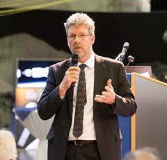
Paul Verhoef, ESA Director of Navigation

Paul Verhoef, ESA Director of Navigation

Following the European Commission’s decision to accelerate development of Galileo Next Generation, ESA has asked European satellite manufacturers to submit bids for the first batch of the Galileo Second Generation (G2) satellites. The new spacecraft are expected to be launched in about four years. Read more…

Galileo High Accuracy Service: Field Experimentation of Data Dissemination Schemes

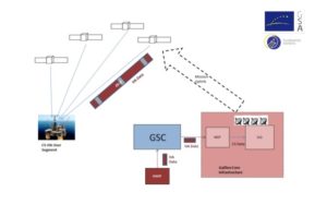
Galileo will provide a High Accuracy Service (HAS) with positioning performance in the 20-cm range, disseminating Precise Point Positioning (PPP) corrections through the Galileo E6-B signal. Test results of a data encoding and dissemination scheme in different user environments demonstrate a reception time of the corrections in a few seconds in good channel conditions, and less than half a minute with severe channel impairments.

Galileo High Accuracy Service Architecture

Galileo High Accuracy Service Architecture

The Galileo High Accuracy Service (HAS) will provide Precise Point Positioning (PPP) corrections enabling position accuracies in the 20-cm range. Such level of accuracy, and the fact that it will be provided for free Read more…

“I am a true believer in the European project” – Carlo des Dorides

Carlo des Dorides took up his position as executive director of the European GNSS Agency (GSA) on February 1, 2011. In the nine years since then, the Galileo programme has progressed from a project on paper to an operational programme with over a billion users around the globe. As his term at the helm of the Agency draws to an end, the GSA executive director looks back at the successes and challenges of the past nine years and speaks about his hopes for the future.

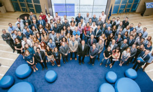
Carlo des Dorides and his team at GSA headquarters in Prague

Carlo des Dorides and his team at GSA headquarters in Prague

During your nine years at the head of the GSA there have been significant advances in the European GNSS programme. What do you see as the greatest achievement during your term? Read more…

Reaching you faster – when every minute matters

Search and Rescue (SAR) operations involve locating and helping people in distress. They can be carried out in a variety of locations including at sea, in mountains or deserts, and in urban areas. With the launch of Initial Services, Galileo will help SAR operators respond to distress signals faster and more effectively while also lowering their own exposure to risk… Search and Rescue service is Galileo’s contribution to the international Cospas-Sarsat network. Galileo is a EU programme, carried out in cooperation with the European Space Agency.